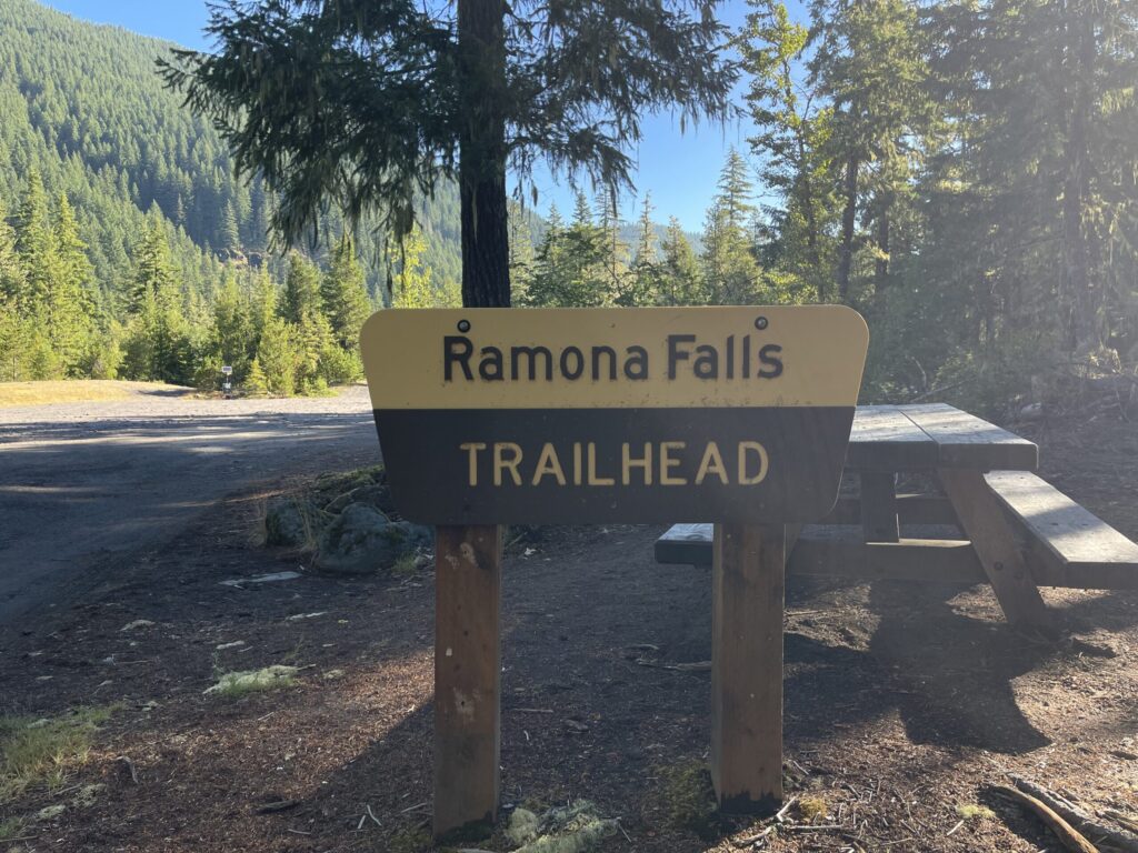
Hike number six of the season, which was also my final hike of the summer: Ramona Falls Loop, a seven-mile loop along the Pacific Crest Trail in Mount Hood National Forest, about an hour outside of Portland.
This trail is fairly flat—there’s only about a thousand feet of elevation gain overall—and therefore very dog- and kid-friendly (dogs must be leashed). I saw a handful of families with children of various ages camping in the backcountry, including one family with younger kids (they looked to be early elementary school age) on a multi-day backpacking trip.
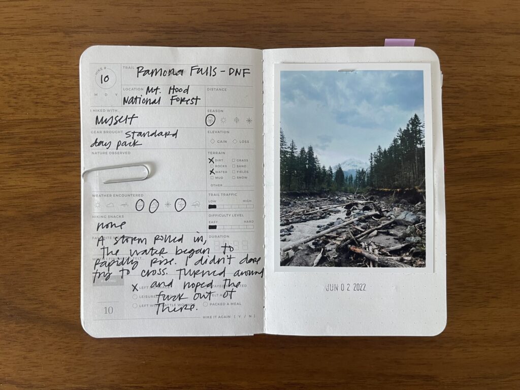
I first attempted this hike in early June 2022. I went much later in the day than usual and right as I approached the river crossing it began sleeting and then snowing, which I, an unseasoned Oregon hiker at the time, didn’t expect so close to the start of summer. The river was flowing much faster than I expected, and the water was freezing. Combined with the surprise weather, being out there on my own, and my naturally extremely anxious and catastrophizing brain, I was too nervous to attempt the river crossing. I turned around and walked the mile back to my car.
This time, I went much earlier in the day and much later in the season, crossed the river just fine both times, and finally finished this hike.
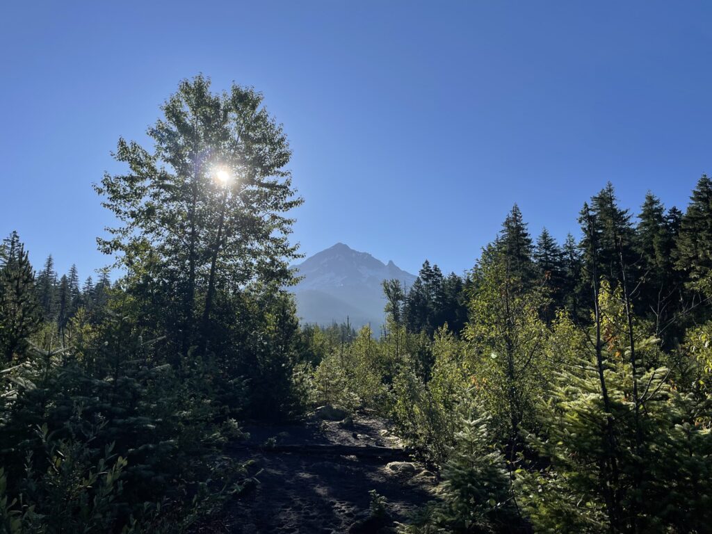
Like many Oregon summer mornings, it was overcast when I began (shortly after 5:30 am).
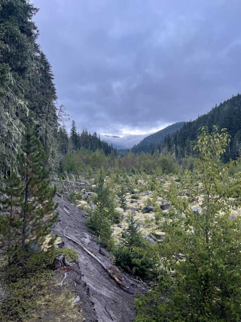
And like many Oregon summer mornings, less than two hours later, the sky was completely clear and the sun hung high.
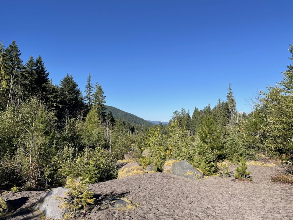
Most of this hike is through tree canopy, some of it very thick overhead, which is a blessing on clear, hot day. There are only a few short stretches where you’re directly exposed to the sun. Because I went counterclockwise, I hit most of these stretches at the end of my hike. If you go clockwise, you’ll hit these stretches at the start of your hike; or, if you begin early enough on an overcast day, you’ll avoid most of them altogether. I recommend going counterclockwise; it provides a much more dramatic first visual of the falls.
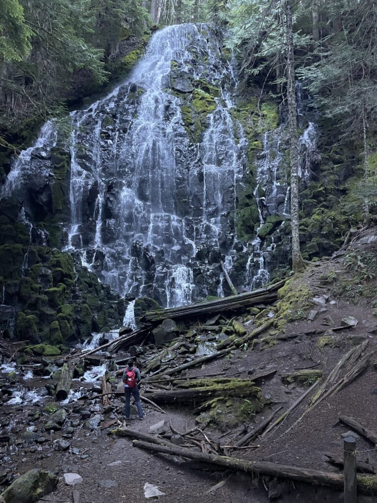
Per usual, in the days leading up to this hike, I checked the trail’s AllTrails page for new reviews/comments. There was a single one that mentioned how enormous the falls are in person; how photos don’t clearly convey the size of the thing. Reader, that hiker was correct. This thing is massive. Look how tiny I am in comparison!
There are several spots to camp next to and just beyond (or, if you’re going clockwise, just before) the falls. Also just beyond (or, if you’re going clockwise, just before) the falls: incredibly beautiful cliff faces of rusty orange and milky blue and grey rock (?).
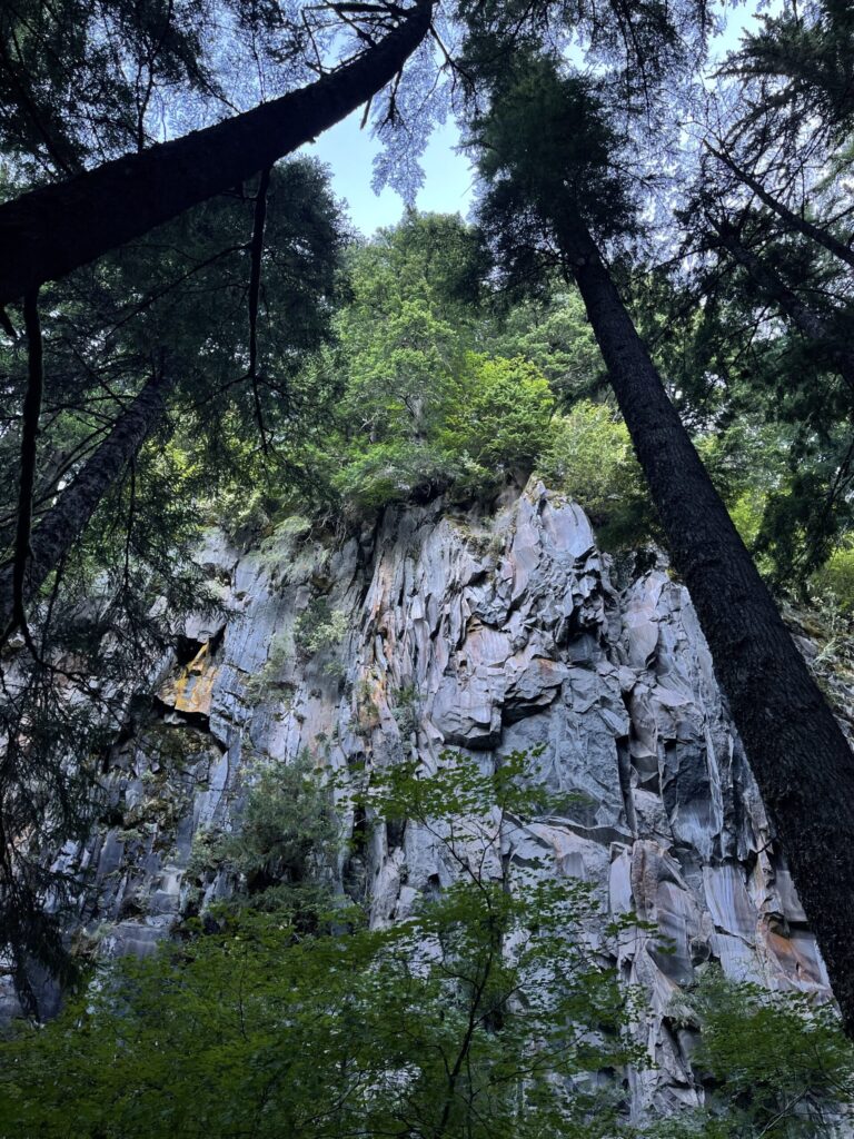
These cliff faces were enormous. They looked so slick and smooth and sharp and, with the sun rising overhead, they appeared at times to glimmer and glow. There was nothing about these cliff faces in any of the AllTrails comments/reviews I read. Coming upon them was a very unexpected surprise, and a much better unexpected surprise than sleet and snow and a rising, raging river.
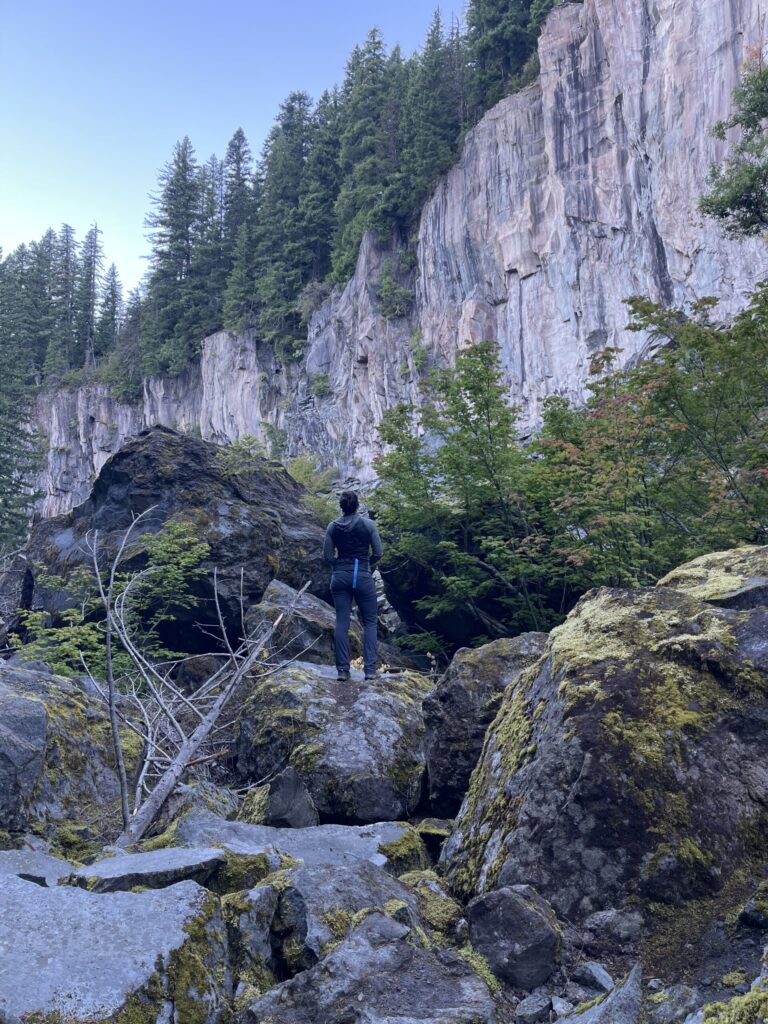
I wish I’d been able to better capture their beauty with my iPhone camera.
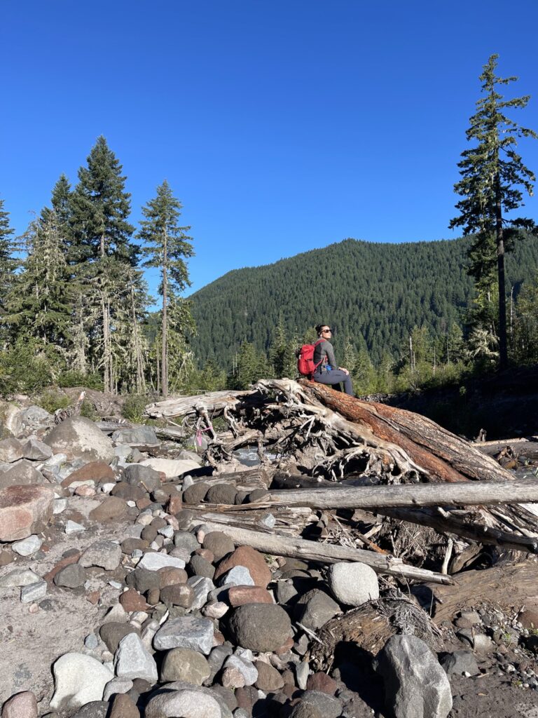
By the time I hit the river crossing on my return, the day was fully awake. Unfortunately, the sun rising over Mount Hood made it impossible to get a photo of the mountain in which it didn’t look completely washed-out.
It was still early when I hit the river crossing on my way back—a few minutes after 8:00 am. I wasn’t ready to leave yet. The sun felt so nice, the scenery was so beautiful, and no one else was out there. So, I set up on some wide, sturdy logs, and spent some (more) time taking it all in.
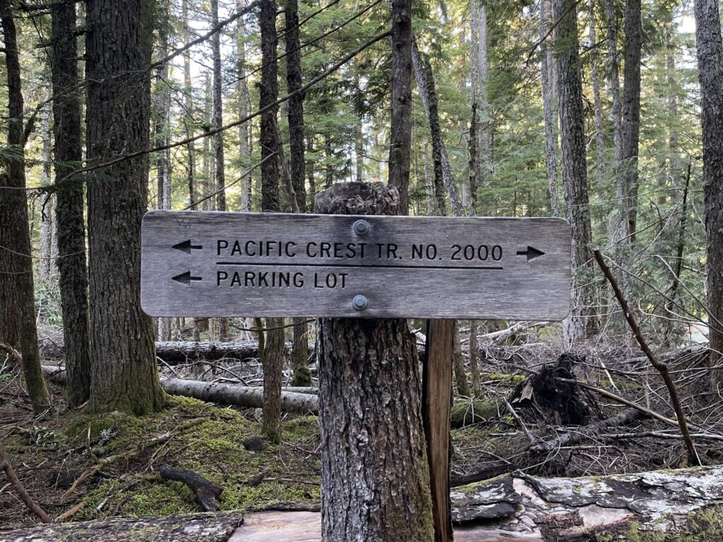
This hike is fully in the backcountry. As such, there’s no cell service beginning about four miles before the trailhead. If you attempt this hike, make sure you’re prepared for the water crossing and for being completely out of cell service range; check recent reports about trail and river conditions in the days leading up to your hike. Download your trail map and any music or podcasts you plan to listen to on the trail before you leave home. You’ll be able to easily navigate back to the main road without GPS—there’s plenty of clear signage, and most of the time, there’s only one way you can go.
The parking lot is huge. It could easily fit probably a couple hundred vehicles. Both times I’ve been here, there’s been at least one porta-pottty; best to come equipped with your own toilet paper. The road leading to the trailhead is single-lane in some stretches and has some pretty gnarly potholes, though there are significantly fewer of them, and they’re much less gnarly, now than in 2022. Pay attention and, if you, like me, don’t have a rugged outdoor vehicle, maybe go a little slower than you think you need to. What a bitch it would be to pop a tire out there on a narrow-ass road several miles from cell service.